Monday, 4 October 2010

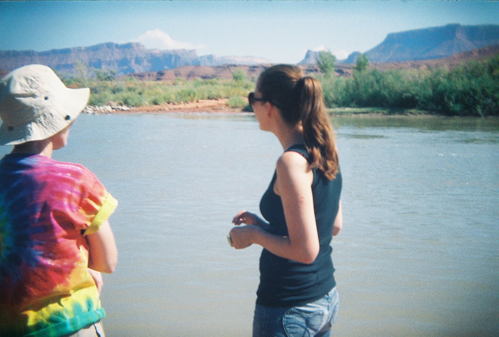
Some Random Holga Shots

I just got a roll of film developed from my little plastic camera...


Zion and Bryce

With the desert behind us we continued into Utah. I have to be honest, my knowledge of this state prior to arrival in the US was limited almost entirely to two basic facts;

1 - This is the state where lots of Mormons live.

2 - Johnny Utah was the name of Keanu Reeves character in Point Break.

Pitiful. The reality is that this state offers some of the most breathtaking scenery on the planet. So, equipped with a little research and the ringing endorsement of a few people in San Francisco, we ventured on into the 45th state with open minds and a will to see something beautiful.

Utah gets its name from Ute tribe (Native Americans) and it basically means "people of the mountains". This name seems immediately appropriate when you arrive from the south west, and see a long line of sharp rocky peaks emerging out of a colourful yet quickly passed plateau.

Our first aim was to get to Springdale, a small purpose built town that has been constructed as a gateway into America's second most popular national park.

Upon arrival, via Highway's 56, 15 and 9, we quickly found a campsite on the banks of the Virgin River and slept with an ache of anticipation for the hike that we would take the following day. The next morning we awoke to something truly spectacular; a towering ring of red rock, impossible to see in the dead of night, now cast us in a deep dark shadow. This is just what we had been looking for...

After breakfast, and equipped with some superbly inadequate footwear, we headed into the official state park via a shuttle bus. We then began our hot and sweaty ascent up one of the many trails, keen not to allow our city induced physical frailty to prevent the enjoyment of intense colours and wide expansive views.

Looking at a map of Zion, you can realise how easy it was for the the first few generations of American settlers to leave a permanent mark on their environment. You see, when they arrived here, no geological feature had a (European) name. So within the space of a couple of generations, and for the sake of providing points of reference, it appears that any Tom Dick or Harry has had a go at filling in the blanks. The result to modern ears, at least with regard to this park, is an arbitrary collection of names for rocks and cliffs that provide no historical insight to their significance or events that occurred within their vicinity. It's a pity really, because this is an ancient natural theatre that deserves a little more imagination.

Zion State Park

After a couple of nights in Zion, we took the Beast cross country to the huge amphitheater that is Bryce Canyon. This infinitely calmer state park is genuinely unique. The erosion molded hole that is its focus doesn't look like it belongs on this planet. Instead it looks like a giant sun trap that has captured and softened the glow of what it receives. Strange hoodoos (actual name) stand straight within its basin like the spires of a thousand melted churches. In between the red, orange and white rocks that make these spires, stand lush green trees, flourishing in defiance of their habitat. Quite simply, stunning.

Almost as impressively, I just saw my first chipmonk.

Bryce Canyon

© All Images By Paul

Saturday, 2 October 2010

More Nevada Desert

Confused, I rose the next morning in Tonopah's surreal clown themed motel. I sat up in my bed and rubbed my head waiting for a sharp hangover to kick in. After a couple of minutes, nothing. I had got away with it. This must have had something to do with with the altitude, or the fact that last nights imaginative barmaid had created cocktails designed to enable you to function the next morning. What a genius. There were too many of her creations for me to remember each of them, however two do immediately spring back to mind; The Pink P**** (Sweet schnapps based. Pink. Tasted like bubblegum) & Dirty Bong Water (I don't know what was in this, but it was green and forced an uncontrollable facial gurn after every sip).

The Clown Motel. Tonopah

Long Straight Road

By 11am we had got back on the road to continue our journey east on Highway 6. Like the day before, the scenery remained vast and empty, and the roads remained long and straight. To our right we passed the huge and depressing Nevada Nuclear Test Site, where between 1951 and 1992, there were an unbelievable 928 "announced" controlled nuclear explosions. There is something deeply sobering about the consequences of that and all nuclear testing during this period. The proliferation that was its consequence has made the world a far more dangerous place, and jeopardised the very existence of every man, woman and child on the planet. Why any nation state anywhere feels it has the right to develop weaponry that can destroy the whole planet is beyond me. It truly is human and political arrogance of the worst and most dangerous kind.

Here are some of the local consequences of this testing...

A 1979 study reported in the New England Journal of Medicine concluded that: A significant excess of leukemia deaths occurred in children up to 14 years of age living in Utah between 1959 and 1967. This excess was concentrated in the cohort of children born between 1951 and 1958, and was most pronounced in those residing in counties receiving high fallout.

National Cancer Institute (1997) - determined that 90 atmospheric tests at the Nevada Test Site (NTS) deposited high levels of radioactive iodine-131 ... doses large enough, they determined, to produce 10,000 to 75,000 cases of thyroid cancer.


A Dead Cow

About a third of the way between Tonopah and the Utah state border we swung a right, down State Route 375, which is otherwise known as the "Extraterrestrial Highway". This lightly traveled road was rerouted past the infamous (CIA named) Area 51 following the nuclear testing in the 1950's, and is now a magnet for conspiracy theorists and sky gazers to come and stare excitedly at the stars.

We didn't see anything.

The "Town" of Rachel on the Extraterrestrial Highway

Eventually, the desert was replaced by vegetation, and the welcome sight of greenery and humanity.

After a delicious breakfast in Caliente and with a sigh of relief, we rolled the Beast into Utah and the prospect of three potential highlights of the trip; the state parks of Zion, Bryce & Moab.

Utah State Border

© All Images By Paul

Wednesday, 29 September 2010

Nevada Desert

Despite the fall of darkness, and with fear of further vehicle failure coursing through our veins, we escaped from Reno. Our first aim was to return to California and to head towards Tahoe's southern shore via the postcard towns of Auburn and Grass Valley. These manicured and pretty detours each offered character and history, but each also failed to offer an incentive to remain longer then a couple of hours. Therefore, after one final night in California we stocked up with water and fuel and headed back towards the vast nothingness that dominates so much of the state of Nevada.

Following a short ride on Highway 50, the transition to desert was rapid and severe. Within an hour we were within the rural flatlands of Douglas County. An hour further as we headed southeast on Highway 95, the only vegetation that could be seen was a sparse covering of dry coarse shrubs over an endless layer of light brown dust. As we continued the air became drier and drier and the need for regular hydration quickly intensified. We were in a vast bowl of emptiness that stretched all around us. Only the occasional derelict structure and forgotten town blemished this intimidating lunar landscape. Each of these stood, slowly decaying like failed acts of defiance that forgot just how inhospitable so much of this state is.

Walker Lake

Ghost Town

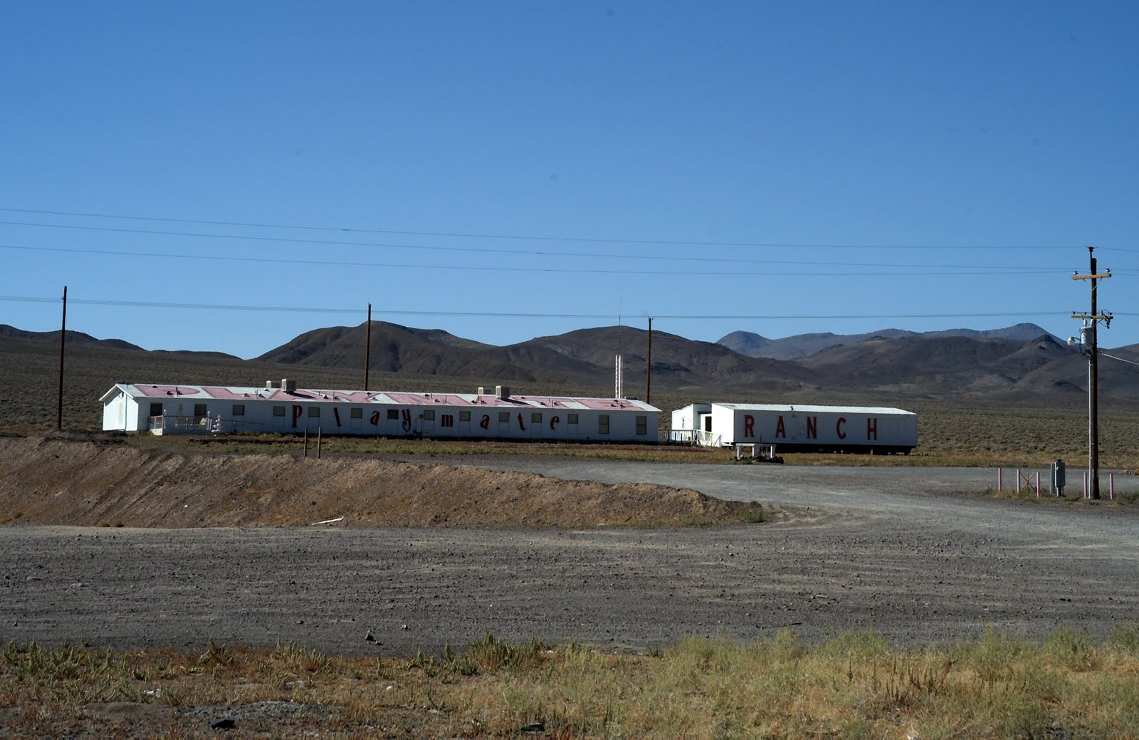
After we had crossed 3 almost infinite straight roads into the horizon, Nevada's more sinister side was exposed. Hawthorn Ammunition Depot, a huge facility that is used to stockpile weaponry emphasised the shear scale of American military strength. Further still, isolated brothels (it's legal in this state) also stood, remote and hidden like the dirty desperate secrets that they facilitate.

"Playmate Ranch" A Legal Nevada Brothel

That night we rolled into a small mining town established, and seemingly forgotten by the tough Wild West pioneers who have been so heavily and justifiably romanticised in American history. Tonopah, which sits in the middle of Highway 95 is best known for its association with the perhaps the most famous American peace officer who ever lived; its former sheriff Wyatt Earp. This is a place where people come to be forgotten, and the towns’ bar is where those forgotten people congregate to ply travelers like us with warmth, friendliness and round after round of free drink. Honestly, I don’t think that I have ever experienced such immediate friendliness anywhere else in the world.

Tonopah

Tonopah Founders Graveyard

© All Images By Paul

Friday, 24 September 2010

Reno

Following a late evening check-in at Reno's Peppermill Resort and Casino I was overwhelmed and disorientated by a neon blur and the ringing of slot machines. Seemingly endless strips of bright lighting clung to every wall and made finding our room intensely difficult. However, a 70's styled black and mirrored room which included a personal bar and jacuzzi, justified the search and set up a perfectly relaxing evening and a good nights sleep.

Inside The Peppermill Resort and Casino

The next day started well enough. We had agreed to do the photography for a wedding up in the beautiful hills that shroud this sprawling and tired older cousin of Las Vegas, and so set off to start work with the wedding location programmed into our Garmin (Sat Nav). This is when things started to go wrong. The maps loaded into this device were obviously out of date and so sent us up a dirt track dotted with potholes and trenches that each took their toll on the Beast. After arrival, the extent of this toll was realised as it slowly sunk before our eyes. Our rear left wheel had dislocate itself from the body of the vehicle. Bugger.

After a call to AAA, a tow courtesy of an entertaining fantasist with no teeth, and much chin scratching by a local mechanic, it soon became clear that we were trapped and would have to wait a further 2 days to make the Beast roadworthy. We were not going to be leaving Reno anytime soon.

Old Town Reno

My first thought after a quick tour of old Reno was that this prospect did not seem unpleasant. However, after 2 days trapped inside the Peppermill, my perception certainly changed. The disorientation felt upon arrival was quickly replaced my nausea. Upon closer inspection, the staples and gaffer tape that hold the rickety and ostentatious aesthetic of this place soon became very clear. In addition, the wall-to-wall mindless gambling opportunities and the people spending so much of their hard earned money made me sad and resentful of such flagrant wastefulness.

After 2 days trapped in a city that you can not navigate as a pedestrian, the eventual resurrection of the Beast was greatly appreciated. It was certainly time to get out of here.

© All Images By Paul
.

Thursday, 23 September 2010

Lake Tahoe

This was our first real opportunity to head inland and away from the long Pacific coastline. So with the Beast temporarily converted back to its primary function of vehicle rather then mobile home, we headed east along Highway 80 towards the alpine beauty of Lake Tahoe. Located in the Sierra Nevada mountains, Tahoe is undeniably picturesque. I had visited this area once before within the dead of winter, when the mountain sides shone a brilliant white under many feet of snow (picture from previoius trip). However this time, under a strong Indian summer, a rich pallet of colours had emerged to greet us. As I looked out over the mirror like lake I couldn't help but think that my eyes were deceiving me as the rich green of a thick woodland was sandwiched between the deep blues of the sky and water. The view looked like a doctored photograph; a complete contrast to the muted tones and diffused light of home, which over many years have dulled my expectation of nature.

Lake Tahoe

That evening we headed over the peaks that dominate the circumference of Lake Tahoe on the way to Reno and the Nevada state border. This involved pushing the Beast to its limits with rises and dips that dwarfed anything I had driven on previously. We had been advised to follow the small mountain pass that is Route 28, and as soon as we crossed the final peak of that mountain range I realised why. There are few words in my limited vocabulary that are capable of describing the view down into Nevada with any justice. All I can say is this is by far the longest and most impressive uninterrupted vista I have ever seen.


Following that treacherous road east and down towards Reno immediately sobered any emotional reaction I was having towards the local environment. This road was going to take its toll unless I dedicated every ounce of concentration in my small brain.
However concentrate I did and eventually, under a rapidly descending blanket of darkness, we entered Reno.

The Sky Over The Nevada Border

© All Images By Paul
.

Tuesday, 14 September 2010

Oregon Countryside & Back To California

With only 3 days remaining before a prior engagement back in Marin we needed to make the most of our time left in Oregon. So with fond memories of the Rogue River in our minds we returned to the coast and headed north toward Battle Rock and Bandon.

At first glance, the modest Battle Rock stands as one of many small rocky islands that pepper the Oregon coastline. However, there is a historical significance to this place that provides insight into the recent history of the (US) pacific coastline.

Story Time...

In 1850, US Congress passed the Oregon Donations Land Act, which basically allowed white settlers to claim lands already populated by the Dene Tsut Dah (Native Americans), without any formal negotiation or treaty. Understandably, this Act constructed a recipe for conflict, and in 1851 that conflict arrived when nine men under the command of Captain William Tichenor landed at what is now Battle Rock. For 2 weeks the bravery and gun powder possessed by these nine white settlers repelled an understably irate collection of poorly armed Indian warriors. Eventually, after escaping under the cover of night, Captain William Tichenor and his men returned to this site with a fully equipped army to sweep away any resistance, establish a permanent white settlement and change the course of local history for ever.


Battle Rock

Oregon Coastline

After Battle Rock our journey then took us back towards Highway 5, inland through the open green fields that dominate this beautifully under developed state. We then continued south, eager to put some miles on the clock and reduce the distance between us and Novato. Just shy of the border we rested up in a bland cheap motel in Medford, a sprawl of a former railroad town where we could find little to do other then eat a very large pizza in one of the string of out of town restaurants that appear to define the gastronomic possibilities on offer in this part of the world. The next day we continuing south past the immense Mount Shasta on the way to a comfortable campsite on the banks of Lake Solano. Here, in beautiful and natural surroundings we endeavoured to cook and eat, despite the persistent efforts of a half dozen crazed peacocks who were eager to steal our food.


Mount Shasta

Lake Solano


Crazed Peacock

© All Images By Paul

Sunday, 12 September 2010

Oregon Border and The Rogue River

With the state border now firmly in our sights we continued north towards Oregon. I had heard a lot about this state from some adventurous friends of ours who had explored most of America as a part of their own mammoth tour about 12 months ago (Hi Sam & Fi). With their endorsement ringing in my ears, I was looking forward to what lay ahead past the two deeply forgettable towns of Crescent City and Eureka.

As we progressed, we were regularly side-tracked by an increasing number of road side tourist attractions each aimed at distracting the steady stream of road trippers who appear to descend upon the Pacific Coast. Each of these boasted the worlds longest, highest and heaviest something or other, and most immediately faded from memory. Two did stand out however; the first being a moderately historic school called 'Stone Lagoon' which was surrounded by an impressive herd of Elks and the second being a massive moving and talking statue of the mythological lumberjack Paul Bunyan.

Stone Lagoon School House (& Elk)

Paul Bunyan Statue

Eventually, the sun light descended into a lush golden glow as we crossed the Oregon border and continued north up to the Rogue River and promises of a camp site nestled along one of its' many meanders. Finally, after what seemed like an age we reached 'Kimbal Bend' where our wait for a decent place to camp was immediately justified. As we looked out, the banks of the river eased into a gently flowing current. Otters could be seen swimming within the cold open waters, by which we sat and enjoyed giant gin-and-tonics as the day faded into night. We then headed back to our camp where we cooked and ate under the dim glow of candle light and our small propane burner.

Rebecca with Gin & Tonic

Banks of the Rogue River at Sun Set

The following morning, after a long and relaxing night within the bowel of the beast we headed to the Rogue and swam in the calm and very fresh waters of the river. We then returned to our vehicle, which was almost entirely enclosed in a large horseshoe of monster RV's each casting a shadow on our modest chariot. It was time to hit the road once more.

The Rogue River prior to an early morning swim.

© All Images By Paul

Saturday, 11 September 2010

Ferndale and Trinidad

After leaving Mendocino we followed Highway 1 north. This took us along a thinly carved road that ran around and over every contour of a mountainous forest. With my teeth gritted and the whites of my knuckles exposed, I followed that path of tarmac as quickly as I could. Eventually, after the constant dipping and swerving had taken its toll on Rebecca, we emerged at Leggett and the first traditional motorists tourist trap of our trip.

Standing at 315 feet, The Chandelier Tree has been attracting faint and weary tourists since the 1930's due to the 6 by 6 foot hole that has been cut through its base to needlessly facilitate the passage of motor vehicles. Whilst I am not a fan of the vandalism that this attraction represents, I was attracted by its historic appeal; so we paid our $8 and drove through this magnificent redwood en route to the pleasant park that lay beyond it.

The Chandelier Tree

Our next stop was Ferndale, a recommended detour off Highway 101 north of the impressive 'Valley of Giants' stretch of that long and impressive road. Like a scene from an eerie 1950's television show, this place was both pretty and breathtakingly odd. Empty streets dominated and personal possessions were left out in the evening sunshine in anticipation of the towns annual yard sale that was due to take place the following day.

Ferndale

The next morning we tried to pay for our camping but failed as the only attendant assigned to the campsite was nowhere to be seen, and had been nowhere to be seen since we arrived the night before. Therefore with an extra $10 in our pocket we headed north toward Trinidad, a small town hugging the ocean, which appears to have been neglected by many of the guide books that we have read to date. We both immediately liked this place and its small community vibe. This isn't a town trying to be anything other then is, which is a friendly community overlooking the most beautiful beach either of us had seen so far.

Trinidad Beach

A Dead Shark

© All Images By Paul

Friday, 10 September 2010

Nudity Under A Naked Sky

So with excitement coursing through my veins, we finally left camp Novato and Rebecca's Mothers' immensely appreciated hospitality (thank you Kristin).

Our first stop after a short trip up Highway 101, was deep in Hendy Woods State Park, or more specifically at a small and remote resort called Orr Hot Springs. This visit was the result of Miss Rebecca's enthusiastic endorsement of the affect that the minerals contained within the local spring water could and would have on our bodies. I was skeptical about this, but eager as I was to spend our first night in the beast 'car camping' (official term... apparently), I gladly agreed to give the mystical local water and the above mentioned resort a go.

The resort comprised of an intimate collection of wooden huts each equipped to provide its inhabitants with varying levels of comfort (depending upon how much they pay). As we were sleeping in our car we immediately headed past these and went straight to Orr's moderately sized bath house. Once inside, the 'clothing optional' resort policy was immediately translated for us by the presence of a healthy number of middle aged woman, each blissfully in the nude. It was soon very obvious that there was no choice but to do this as god intended, so with a deep breath we both disrobed. Miss Rebecca, like the brave Californian that she is, headed straight to the public baths. I, being the predictable English prude that I am, did not.

Eventually, after a short and very relaxing soak in a private bath, I decided to take one for queen and country. So with my towel thrown boldly over my shoulder, I marched into the public bathing area to join Rebecca.

That night, after an awful meal of tinned soup and soggy pre-packaged bagel, we returned to the bath house to relax under a sky that contained more stars then I have ever seen. I'm not sure about the minerals; but laying in a warm pool in the middle of a forest staring up at the majesty of the nights sky certainly does something positive for your soul.

Our Orr Springs 'Car Camping' Spot

The next morning, after a disorientating but ultimately successful first night sleeping in the beast we drove west to Highway 1 and Mendocino. This undoubtedly pretty (self described) artist colony and museum town was the perfect place to eat breakfast and watch the morning mist evaporate into the sky.


Mendocino

© All Images By Paul